Ladawan:Surigao province map 1918.JPG
Pakadakula kan pasirip na ini: 371 × 600 na pixel. Ibang mga resolusyon: 148 × 240 na pixel | 633 × 1,023 na pixel.
Orihinal na file (633 × 1,023 na pixel, pakadakula: 177 KB, tipo nin MIME: image/jpeg)
Sumaryo
| Pagladawan |
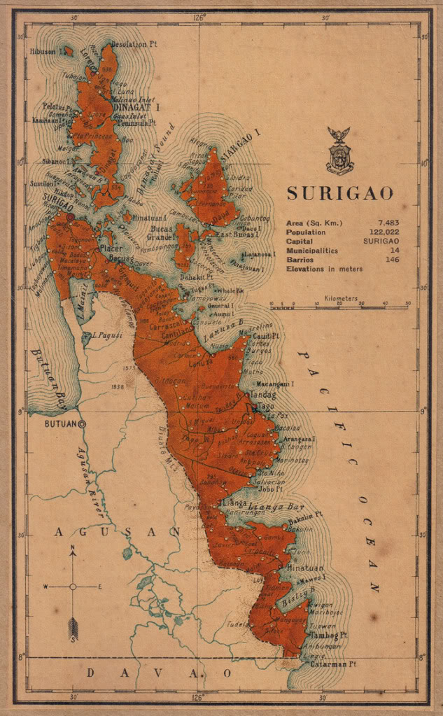
English: Map of Surigao province in 1918 |
| Petsa | |
| Pinagkunan | Census of the Philippine Islands (1918) |
| Kagsurat | Census Office of the Philippine Islands |
Paglisensya
This media file is in the public domain in the United States. This applies to U.S. works where the copyright has expired, often because its first publication occurred prior to January 1, 1929, and if not then due to lack of notice or renewal. See this page for further explanation.
|
 | |
 |
This image might not be in the public domain outside of the United States; this especially applies in the countries and areas that do not apply the rule of the shorter term for US works, such as Canada, Mainland China (not Hong Kong or Macao), Germany, Mexico, and Switzerland. The creator and year of publication are essential information and must be provided. See Wikipedia:Public domain and Wikipedia:Copyrights for more details.
|
Kasaysayan kan file
Pinduton an sarong petsa/oras para mahiling ng file sa puntong idto.
| Petsa/Oras | Thumbnail | Sukol | Paragamit | Komento | |
|---|---|---|---|---|---|
| presente | 04:13, 3 Agosto 2015 | | 633 × 1,023 (177 KB) | Namayan | User created page with UploadWizard |
Paggamit sa file
Mayong pahinang naggagamit sa file na ini.
Pankinaban na paggamit sa file
Ginagamit kan mga minasunod na wiki an file na ini:
- Paggamit sa ar.wikipedia.org
- Paggamit sa en.wikipedia.org
- Paggamit sa es.wikipedia.org
- Paggamit sa ka.wikipedia.org
- Paggamit sa ko.wikipedia.org
- Paggamit sa simple.wikipedia.org
- Paggamit sa www.wikidata.org