Ladawan:Provinces of Cameroon numbered.svg

Orihinal na file (SVG na file, nominal na 586 × 769 (na) pixel, pakadakula: 1.22 MB)
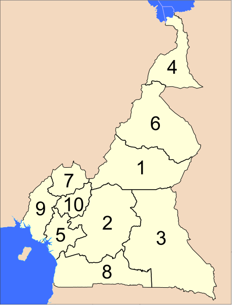
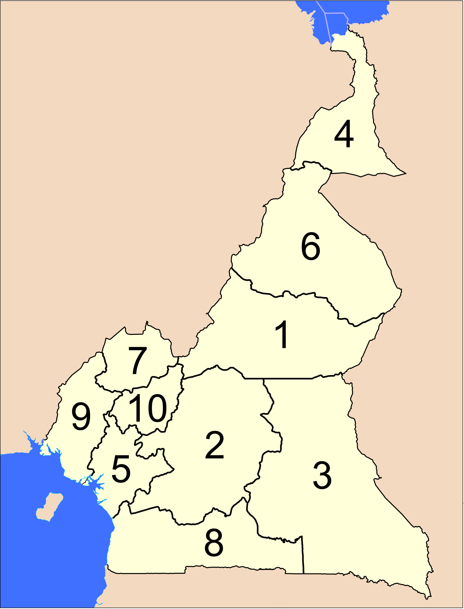
The provinces of Cameroon.
Modified from http://www.un.org/Depts/Cartographic/map/profile/cameroon.pdf
| This image is a map derived from a United Nations map.
Unless stated otherwise, UN maps are to be considered in the public domain. This applies worldwide. UN maps are, in principle, open source material and you can use them in your work or for making your own map. UN requests however that you delete the UN name, logo and reference number upon any modification to the map. Content of your map will be your responsibility. You can state in your publication, if you wish, something like: based on UN map … (map name, map number, revision number and date). See: Geospatial Information Section. And: Geospatial, location data for a better world. |
 |
Kasaysayan kan file
Pinduton an sarong petsa/oras para mahiling ng file sa puntong idto.
| Petsa/Oras | Thumbnail | Sukol | Paragamit | Komento | |
|---|---|---|---|---|---|
| presente | 04:39, 10 Abril 2007 | | 586 × 769 (1.22 MB) | Interiot~commonswiki | The provinces of Cameroon. Modified from http://www.un.org/Depts/Cartographic/map/profile/cameroon.pdf {{UN map}} Category:SVG maps of Africa |
Paggamit sa file
Ginagamit kan minasunod na pahina an file na ini:
Pankinaban na paggamit sa file
Ginagamit kan mga minasunod na wiki an file na ini:
- Paggamit sa ab.wikipedia.org
- Paggamit sa ar.wikipedia.org
- Paggamit sa be-tarask.wikipedia.org
- Paggamit sa be.wikipedia.org
- Paggamit sa bg.wikipedia.org
- Paggamit sa ca.wikipedia.org
- Paggamit sa cs.wikipedia.org
- Paggamit sa de.wikipedia.org
- Paggamit sa en.wikipedia.org
- Paggamit sa es.wikipedia.org
- Paggamit sa eu.wikipedia.org
- Paggamit sa fa.wikipedia.org
- Paggamit sa fi.wikipedia.org
- Paggamit sa guw.wikipedia.org
- Paggamit sa hr.wikipedia.org
- Paggamit sa id.wikipedia.org
- Paggamit sa ja.wikipedia.org
- Paggamit sa ka.wikipedia.org
- Paggamit sa ko.wikipedia.org
- Paggamit sa li.wikipedia.org
- Paggamit sa lt.wikipedia.org
- Paggamit sa mk.wikipedia.org
- Paggamit sa mt.wikipedia.org
- Paggamit sa nl.wikipedia.org
- Paggamit sa no.wikipedia.org
- Paggamit sa pt.wikipedia.org
- Paggamit sa ru.wikipedia.org
- Paggamit sa sco.wikipedia.org
- Paggamit sa simple.wikipedia.org
- Paggamit sa si.wikipedia.org
- Paggamit sa sr.wikipedia.org
- Paggamit sa sv.wikipedia.org
- Paggamit sa tr.wikipedia.org
- Paggamit sa uk.wikipedia.org
- Paggamit sa ur.wikipedia.org
- Paggamit sa zh-min-nan.wikipedia.org
- Paggamit sa zh.wikipedia.org