Ladawan:Map of USA HI full.png
Mayo na nin mas malinaw.
Map_of_USA_HI_full.png (286 × 186 na pixel, pakadakula: 21 KB, tipo nin MIME: image/png)
Sumaryo

|
File:Map of USA HI full.svg is a vector version of this file. It should be used in place of this PNG file when not inferior.
File:Map of USA HI full.png → File:Map of USA HI full.svg
For more information, see Help:SVG. |
 |
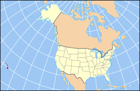
| Pagladawan | Map of USA with Hawaii highlighted and shown in true position |
| Pinagkunan | http://www.nationalatlas.gov/printable/reference.html |
| Kagsurat |
Paglisensya
This map was obtained from an edition of the National Atlas of the United States. Like almost all works of the U.S. federal government, works from the National Atlas are in the public domain in the United States.
Online access: NationalAtlas.gov | 1970 print edition: Library of Congress, Perry-Castañeda Library
|
Kasaysayan kan file
Pinduton an sarong petsa/oras para mahiling ng file sa puntong idto.
| Petsa/Oras | Thumbnail | Sukol | Paragamit | Komento | |
|---|---|---|---|---|---|
| presente | 16:30, 2 Abril 2007 | | 286 × 186 (21 KB) | MattWright | fix to more standard map colors |
| 19:09, 1 Abril 2007 |  | 286 × 186 (19 KB) | MattWright | {{Information |Description=Map of USA with Hawaii highlighted and shown in true position |Source=http://www.nationalatlas.gov/printable/reference.html |Date= |Author= |Permission= |other_versions= }} Category:Maps of the United States [[Category:Maps |
Paggamit sa file
Ginagamit kan minasunod na pahina an file na ini:
Pankinaban na paggamit sa file
Ginagamit kan mga minasunod na wiki an file na ini:
- Paggamit sa bo.wikipedia.org
- Paggamit sa da.wikipedia.org
- Paggamit sa en.wikipedia.org
- Paggamit sa es.wikipedia.org
- Paggamit sa fa.wikipedia.org
- Paggamit sa hu.wikipedia.org
- Paggamit sa id.wikipedia.org
- Paggamit sa ja.wikipedia.org
- Paggamit sa ko.wikipedia.org
- Paggamit sa mrj.wikipedia.org
- Paggamit sa mr.wikipedia.org
- Paggamit sa pl.wikipedia.org
- Paggamit sa pl.wikinews.org
- Paggamit sa pl.wiktionary.org
- Paggamit sa ro.wikipedia.org
- Paggamit sa sv.wikipedia.org
- Paggamit sa uk.wikipedia.org
- Paggamit sa vi.wikipedia.org