Ladawan:Location Malawi AU Africa.svg

Size of this PNG preview of this SVG file: 646 × 600 na pixel. Ibang mga resolusyon: 258 × 240 na pixel | 517 × 480 na pixel | 827 × 768 na pixel | 1,103 × 1,024 na pixel | 2,206 × 2,048 na pixel | 1,400 × 1,300 na pixel.
Orihinal na file (SVG na file, nominal na 1,400 × 1,300 (na) pixel, pakadakula: 2.17 MB)
Sumaryo
| Pagladawan |
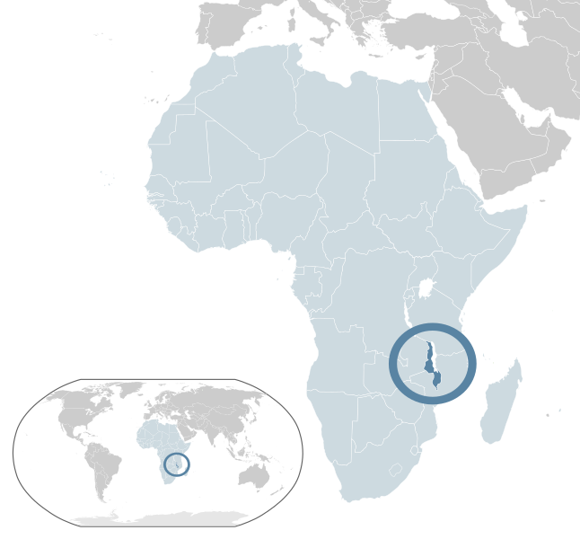
English: Map of Malawi
Español: Mapa de Malaui |
| Petsa | |
| Pinagkunan | Sadiring gibo |
| Kagsurat | Alvaro1984 18 |
Paglisensya
| I, the copyright holder of this work, release this work into the public domain. This applies worldwide. In some countries this may not be legally possible; if so: I grant anyone the right to use this work for any purpose, without any conditions, unless such conditions are required by law. |
Kasaysayan kan file
Pinduton an sarong petsa/oras para mahiling ng file sa puntong idto.
| Petsa/Oras | Thumbnail | Sukol | Paragamit | Komento | |
|---|---|---|---|---|---|
| presente | 10:05, 13 Pebrero 2017 | | 1,400 × 1,300 (2.17 MB) | Chipmunkdavis | Updating Morocco |
| 20:06, 2 Agosto 2013 |  | 1,400 × 1,300 (2.17 MB) | Flappiefh | Added South Sudan. | |
| 11:38, 30 Hulyo 2009 |  | 1,400 × 1,300 (2.17 MB) | Alvaro1984 18 | {{Information |Description={{en|1=Map of Malawi}} {{es|1=Mapa de Malaui}} |Source=trabajo propio (own work) |Author=Alvaro1984 18 |Date=30/07/2009 |Permission= |other_versions= }} Category:Location maps of Africa [[Category:Mal |
Paggamit sa file
Ginagamit kan minasunod na pahina an file na ini:
Pankinaban na paggamit sa file
Ginagamit kan mga minasunod na wiki an file na ini:
- Paggamit sa af.wikipedia.org
- Paggamit sa ami.wikipedia.org
- Paggamit sa ar.wikipedia.org
- Paggamit sa az.wikipedia.org
- Paggamit sa ban.wikipedia.org
- Paggamit sa ba.wikipedia.org
- Paggamit sa be.wikipedia.org
- Paggamit sa bg.wikipedia.org
- Paggamit sa bn.wikipedia.org
- Paggamit sa ca.wikipedia.org
- Paggamit sa cdo.wikipedia.org
- Paggamit sa ceb.wikipedia.org
- Paggamit sa chr.wikipedia.org
- Paggamit sa crh.wikipedia.org
- Paggamit sa cv.wikipedia.org
- Paggamit sa el.wikipedia.org
- Paggamit sa en.wikipedia.org
- Paggamit sa eu.wikipedia.org
- Paggamit sa fa.wikipedia.org
- Paggamit sa fi.wikipedia.org
- Paggamit sa fr.wikipedia.org
- Paggamit sa gn.wikipedia.org
- Paggamit sa gu.wikipedia.org
- Paggamit sa hak.wikipedia.org
- Paggamit sa ha.wikipedia.org
- Paggamit sa hi.wikipedia.org
- Paggamit sa hu.wikipedia.org
- Paggamit sa ie.wikipedia.org
- Paggamit sa ilo.wikipedia.org
- Paggamit sa incubator.wikimedia.org
- Paggamit sa ja.wikipedia.org
- Paggamit sa kk.wikipedia.org
- Paggamit sa km.wikipedia.org
- Paggamit sa lb.wikipedia.org
- Paggamit sa lez.wikipedia.org
- Paggamit sa lfn.wikipedia.org
- Paggamit sa lg.wikipedia.org
Hilingon an kadagdagan na pankinaban na paggamit sa file na ini.