Ladawan:Ise in Mie Prefecture Ja.svg

Orihinal na file (SVG na file, nominal na 460 × 802 (na) pixel, pakadakula: 15 KB)
Sumaryo
| Pagladawan |
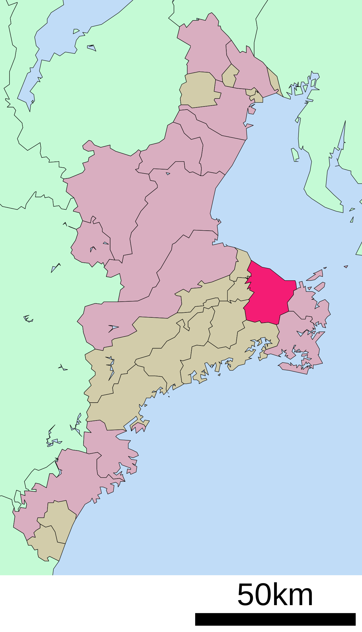
English: Location of Ise in Mie Prefecture
|
||
| Petsa | |||
| Pinagkunan |
|
||
| Kagsurat | Lincun | ||
| Pagtugot (Giraray na paggamit sa file) |
|
Paglisensya

|
Tinutugutan an pagkopya, pagpanao, asin/o pagbago sa dokumentong ini sa irarom kan mga termino kan GNU Free Documentation License, Bersyon 1.2 o dawa anong mas bagong bersyon na naipublikar kan Free Software Foundation; na mayong paburubagong seksyon, mayong teksto sa front-cover, asin walang teksto sa back-cover. Igwang nakalaag na kopya kan lisensya sa seksyon na may titulong GNU Free Documentation License. |
- Talingkas mo ining:
- maihiras – makokopya, maipapanao, asin maipapahiling an gibo
- i-remix – ma-adapt an gibo
- Sa irarom kan mga kondisyon na ini:
- atribusyon – Dapat mong i-credit, itao an link kan lisensya, at itukdo kun may binago ini. Pwede mo ining gibuhon sa dawa anong rasonableng paagi, pero bako sa paaging ineendorso ka o an paggamit mo kan naglisensya.
- share alike – Kun ire-remix mo, babaguhon, o madagdag sa materyal, kaipuhan mong ipanao an mga ambag mo sa irarom kan parehas o katulad na lisensya.
Original upload log
| This file was moved from Japanese Wikipedia.
See below for original file information. | ||||||||||||||||||||||||
| ||||||||||||||||||||||||
|
| ||||||||||||||||||||||||
Kasaysayan kan file
Pinduton an sarong petsa/oras para mahiling ng file sa puntong idto.
| Petsa/Oras | Thumbnail | Sukol | Paragamit | Komento | |
|---|---|---|---|---|---|
| presente | 21:54, 11 Hulyo 2009 | | 460 × 802 (15 KB) | Krisgrotius | {{Information| |Description= Location of Ise in Mie Prefecture |Source= Japanese wiki [http://ja.wikipedia.org/wiki/%E3%83%95%E3%82%A1%E3%82%A4%E3%83%AB:%E5%9F%BA%E7%A4%8E%E8%87%AA%E6%B2%BB%E4%BD%93%E4%BD%8D%E7%BD%AE%E5%9B%B3_24203.svg] |Date=~~~~~ |A |
| 12:24, 8 Oktubre 2007 |  | 460 × 802 (15 KB) | Lincun | {{基礎自治体位置図画像情報|三重県|伊勢市}} |
Paggamit sa file
Ginagamit kan minasunod na pahina an file na ini:
Pankinaban na paggamit sa file
Ginagamit kan mga minasunod na wiki an file na ini:
- Paggamit sa ar.wikipedia.org
- Paggamit sa azb.wikipedia.org
- Paggamit sa ca.wikipedia.org
- Paggamit sa ce.wikipedia.org
- Paggamit sa ckb.wikipedia.org
- Paggamit sa de.wikipedia.org
- Paggamit sa en.wikipedia.org
- Paggamit sa eo.wikipedia.org
- Paggamit sa es.wikipedia.org
- Paggamit sa et.wikipedia.org
- Paggamit sa eu.wikipedia.org
- Paggamit sa fa.wikipedia.org
- Paggamit sa fi.wikipedia.org
- Paggamit sa gl.wikipedia.org
- Paggamit sa hy.wikipedia.org
- Paggamit sa id.wikipedia.org
- Paggamit sa ja.wikipedia.org
- Paggamit sa ko.wikipedia.org
- Paggamit sa mzn.wikipedia.org
- Paggamit sa ro.wikipedia.org
- Paggamit sa simple.wikipedia.org
- Paggamit sa sr.wikipedia.org
- Paggamit sa sv.wikipedia.org
- Paggamit sa tt.wikipedia.org
- Paggamit sa uk.wikipedia.org
- Paggamit sa www.wikidata.org
- Paggamit sa zh-min-nan.wikipedia.org
- Paggamit sa zh.wikipedia.org