Ladawan:"Overhanging Mangrove Trees".jpg

Pakadakula kan pasirip na ini: 800 × 600 na pixel. Ibang mga resolusyon: 320 × 240 na pixel | 640 × 480 na pixel | 1,024 × 768 na pixel | 1,280 × 960 na pixel | 2,560 × 1,920 na pixel | 3,648 × 2,736 na pixel.
Orihinal na file (3,648 × 2,736 na pixel, pakadakula: 2.15 MB, tipo nin MIME: image/jpeg)
Sumaryo
| Pagladawan |
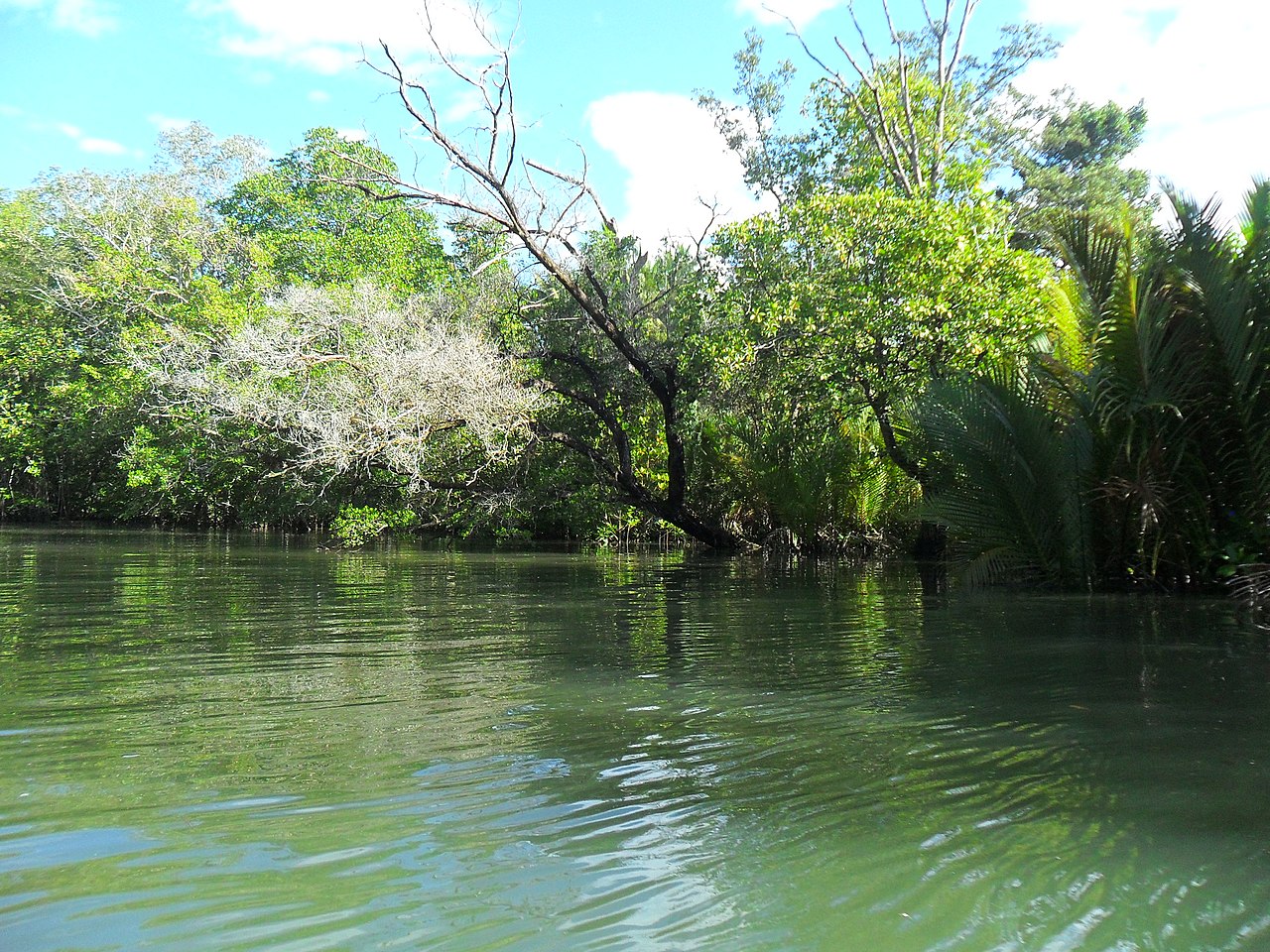
English: Piso Point is where overhanging mangrove trees (of different species) located where during World War II, when Japanese invaded the Southern Philippines, they occupied Davao City and Piso Point. Piso Point was strategically located at the south with many overhanging mangrove trees and the maze inlets river formation which allows the Japanese hid their Suicide Boats to initiate camouflage attack against their enemies. |
| Petsa | 20:41:02 |
| Pinagkunan | Sadiring gibo |
| Kagsurat | Nurz CA |
| Camera location | | View this and other nearby images on: OpenStreetMap |
|---|
Pagatpat Tanawanan Adventure Park (PTAP) could led you for an hour of adventure to this historical places at Barangay Piso, Banaybanay, 8208 Davao Oriental.
Paglisensya
I, the copyright holder of this work, hereby publish it under the following license:
This file is licensed under the Creative Commons Attribution-Share Alike 4.0 International license.
- Talingkas mo ining:
- maihiras – makokopya, maipapanao, asin maipapahiling an gibo
- i-remix – ma-adapt an gibo
- Sa irarom kan mga kondisyon na ini:
- atribusyon – Dapat mong i-credit, itao an link kan lisensya, at itukdo kun may binago ini. Pwede mo ining gibuhon sa dawa anong rasonableng paagi, pero bako sa paaging ineendorso ka o an paggamit mo kan naglisensya.
- share alike – Kun ire-remix mo, babaguhon, o madagdag sa materyal, kaipuhan mong ipanao an mga ambag mo sa irarom kan parehas o katulad na lisensya.
This image was uploaded as part of Wiki Loves Earth 2021.
|
 |
Kasaysayan kan file
Pinduton an sarong petsa/oras para mahiling ng file sa puntong idto.
| Petsa/Oras | Thumbnail | Sukol | Paragamit | Komento | |
|---|---|---|---|---|---|
| presente | 03:51, 23 Hunyo 2021 | | 3,648 × 2,736 (2.15 MB) | Nurz ca | Uploaded own work with UploadWizard |
Paggamit sa file
Ginagamit kan minasunod na pahina an file na ini:
Pankinaban na paggamit sa file
Ginagamit kan mga minasunod na wiki an file na ini:
- Paggamit sa en.wikipedia.org